
The Platform
Theia
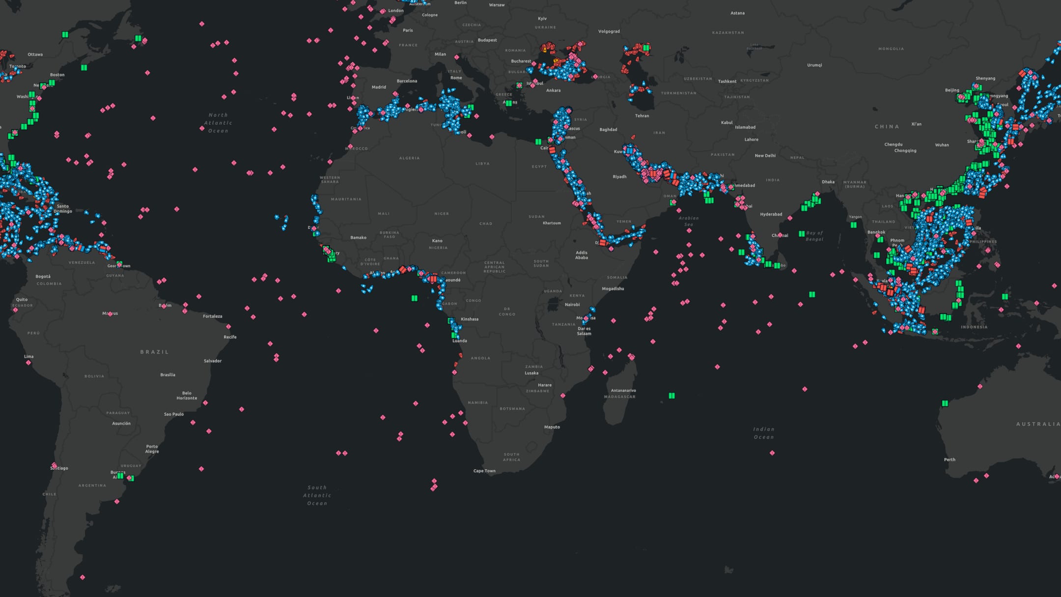
A maritime intelligence platform that fuses AIS, satellite imagery, SAR, and proprietary analytics into one continuous picture of the world’s oceans.
Platform Overview

AIS is the foundation, not the whole picture.
Theia combines AIS data, satellite imagery, synthetic aperture radar, and proprietary analytics into a single intelligence system that monitors maritime activity continuously.
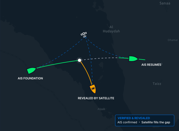
Platforms that depend solely on AIS see only what vessels choose to show. Theia treats AIS as one input among many, layering satellite vessel tracking on top to verify what AIS reports and reveal what it misses, complete vessel tracking, including the activity AIS-only systems cannot see.
Data Capabilities
Four data sources, fused into one picture.

01 / AIS
AIS Data
Self-reported position, identity, and navigation. Theia’s foundational input, verified against satellite observation to expose anomalies, gaps, and deception.

02 / SAR
Synthetic Aperture Radar
Detects vessels in all weather, day or night, through cloud cover, independent of visible light and AIS. How Theia sees through the gaps.

03 / Optical
Satellite Imagery
High-resolution optical imagery for vessel identification, classification, and attribution. Confirms detections and adds visual context.

04 / OSINT
Open-Source Intelligence
Public registries, port records, ownership databases, and sanctions lists enrich vessel profiles and attribution.
Coverage
Continuous, global, verified.
40M+ km²
Earth’s surface analyzed daily
300,000+
Unique vessels monitored
Global
Coverage across the world’s oceans
AI / ML Features
Machine learning across the pipeline.

Detection
Automated Vessel Detection
AI-driven identification of vessels across satellite imagery at global scale.

Recognition
Spoofing Pattern Recognition
Models trained to identify AIS manipulation, position spoofing, MMSI sharing, and GNSS interference.
Behavior
Behavioral Modeling
Pattern-of-life analysis that builds vessel profiles over time, detecting anomalies in routes, speed, port calls, and cargo behavior.
Alerting
Anomaly Alerting
Automated alerts on deviations, dark periods, unexpected stops, route deviations, and proximity events.
Classification
Vessel Classification
Models that classify vessel type, size, and role from imagery alone, independent of self-reported AIS.
Integration Options
Built to fit your workflow.
Theia Dashboard

API Access

Secure Deployment

Data Delivery Formats
Security & Compliance
Built for the most security-conscious organizations.
- Data handling standards appropriate for government and defense use
- Access control and user management for multi-tier organizations
- Secure API authentication and encrypted data delivery
- Compliance with relevant data protection and privacy regulations
- Deployment options for classified or sensitive environments, on request
Get Started
See the platform in action.
Request a demonstration of Theia and see how satellite-verified maritime intelligence changes what you know about the world’s oceans.